Research With Drifters
Surface Ocean Currents:
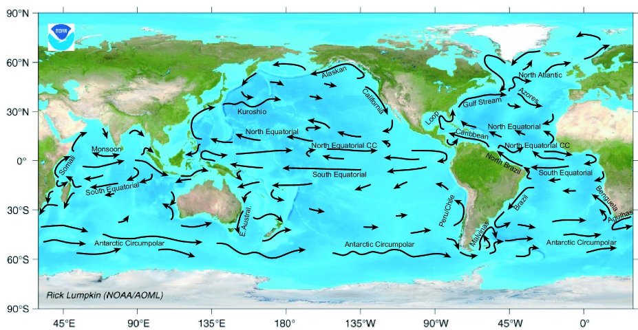
The global array of drifting buoys is invaluable for oceanographic and climate research, as these instruments follow the two-dimensional surface flow, which provides essential information for weather and climate predictions and research, emergency response activities, and nautical navigation.
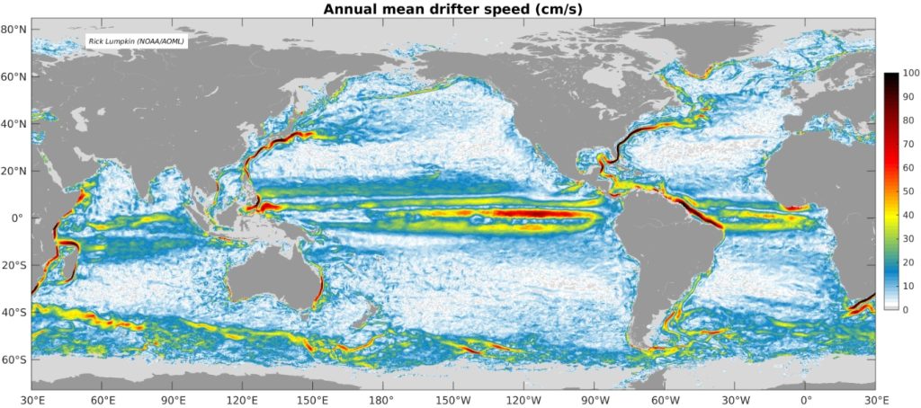
By averaging all the drogued drifters in the data set, a map of time-mean speed can be derived that shows where currents are strong (second photo). This analysis can be used to create an accurate representation of surface current structures and directional flow (top photo).


Disaster Relief:
Every day, drifter measurements provide vital data to calibrate satellite sea surface temperatures and improve weather forecasting. Drifters are also valuable in the event of extreme disasters, such as oil spills and hurricanes.
During the devastating events of the Fukushima earthquake, in 2011, and the Deep Water Horizon oil spill, in 2010, drifters were used to track surface current speed and direction to improve forecasts of debris and oil dispersion. Furthermore, nearby currents were mapped to identify additional potential transport pathways of drifting materials.

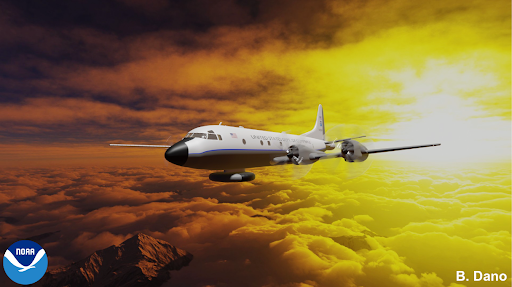
Hurricanes pose yet another important use for drifters, as air-deployed drifters in front of storms help monitor changes in ocean structure during storm passage and improve forecast models. The Global Drifter Program works closely with NOAA’s Office of Marine and Aviation Operations (OMAO) (see photo to the left), NOAA’s Hurricane Research Division (HRD), and the US Air Force’s 53rd Hurricane Hunter Squadron to make these deployments possible.
Additionally, hurricane drifters provide a unique insight into the ocean dynamics and feedbacks from interactions between the ocean and atmosphere that fuel these storms. Forecasters at NOAA’s National Hurricane Center (NHC) rely on a multitude of observations to determine the hurricane’s strength, movement, and eventual path along with the potential for intensification or weakening, so the important data from drifting buoys is used to augment NOAA’s P-3 Aircraft data and satellite imagery data.
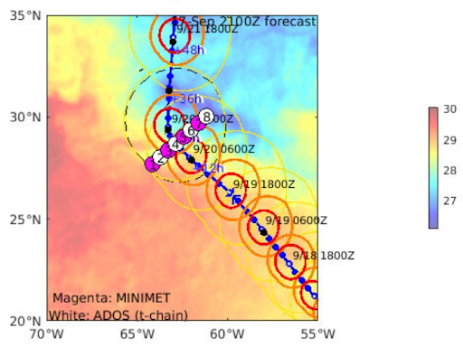
The image at the bottom left shows an array of drifters deployed in front of Hurricane Teddy in September 2020.

Location of 8 pairs of drifters deployed ahead of Hurricane Teddy, superimposed on Sea Surface Temperature (colors). Each pair had a wave drifter and either a Minimet (a standard GDP barometer drifter with wind speed and direction added) or ADOS drifter (replacing the 15m drogue with a thermistor chain to 150m depth).
